🛰️ New — professional service Turn a drone orthophoto (GeoTIFF + surface model) into an interactive map your client simply opens in a browser — sharp to the last centimetre, in 2D and 3D, with measuring tools built in. No GIS software to install, no 100-megabyte files to email: one login, and the survey is there.
Built for land surveyors, planners and drone operators who hand over orthophotos — and for forestry associations, farms, quarries and municipalities who order them.
📤From GeoTIFF to client-ready in one step
You bring the processed orthophoto (and optionally the DSM surface model) from WebODM, Pix4D or any photogrammetry pipeline. We publish it as a fast tile map: it loads instantly at any zoom level, on any device, and the original GeoTIFF stays downloadable for GIS work.
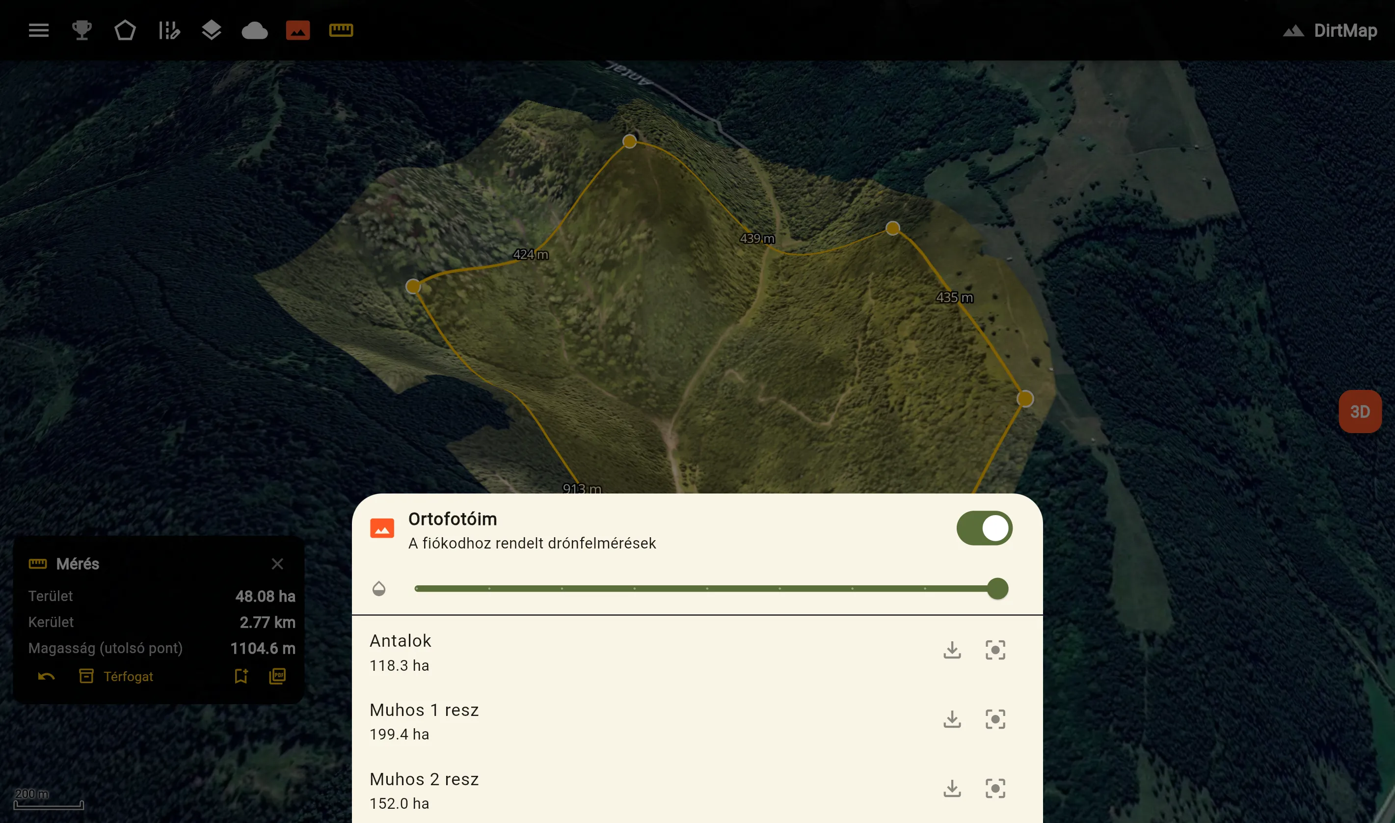
Several surveys can live under one client account — a forestry association sees all its parcels on one map, each with its size in hectares, one tap from jumping to any of them.
📏Measuring tools in the browser
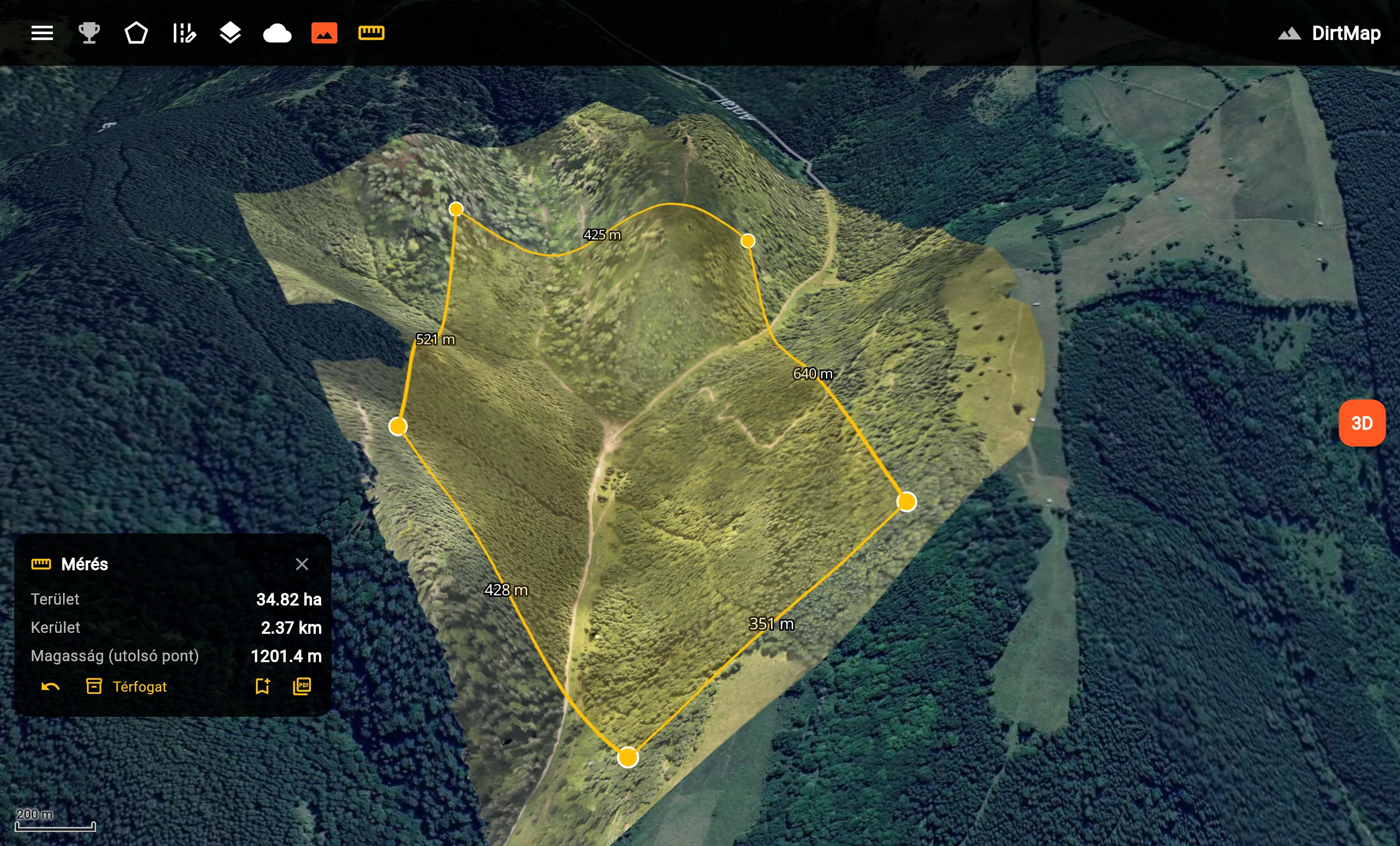
Distance with every leg labelled on the map, area in hectares, and — where a surface model was supplied — volume: draw a polygon around a stockpile, a pit or a windthrow patch and get the cubic metres, computed with the same boundary-plane method WebODM uses (validated to 0.1% against known volumes).
Points can be dragged to fine-tune a measurement, and nothing needs to be installed — it all runs in the browser.
⛰️3D view and the field
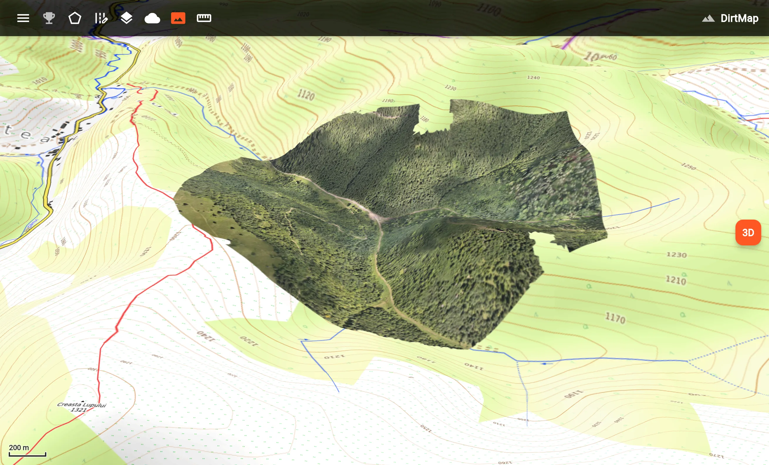
The survey drapes over real 3D terrain — tilt, rotate and fly over it like a sand table.
And because it lives inside the DirtMap app, the field is covered too: in the mobile app the orthophoto shows up as a map layer, with the app’s full navigation toolkit — routes, track recording, offline base maps — working alongside it. The client sees their live GPS position ON the orthophoto: standing in the parcel, they know exactly which tree they are looking at.
🔒Private by design
Surveys are tied to client accounts — there are no public links. Each client signs in and sees exactly their own surveys, nothing else. Handing a survey to a new client is one command on our side; revoking it is just as fast.
Interested?
Whether you are a surveyor who wants a client-friendly delivery portal, or you need a parcel flown and delivered as a ready-to-use map — write to us and we put together an offer.
Get in touch kdrapps25@gmail.com